Dear visitors,
please note that our National Research Network "The Cultural History of the Western Himalaya from the 8th Century (S98)" - generously sponsored by the Austrian Science Fund - has ended on June 30th 2013. For that reason this website will no longer be updated on a regular basis.
For information on our ongoing research, events and activities please refer to the website of our Center for Interdisciplinary Research and Documentation of Inner and South Asian Cultural History (CIRDIS).
Cultural History Information System (S 9808)
| Project Leader: | Ass.-Prof. Mag. Dr. Karel Kriz |
| Members: | Mag. M. Breier; DI L. Brunauer; M. Illmeyer, BSc; Mag.a M. Kinberger; G. Kotzbek; Mag. D. Nell; Mag. A. Pucher |
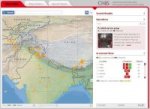
The question that this sub-project seeks to answer is "How can a Geographic Information System (GIS) be assembled to deliver an integrated cartographic decision-support tool for information collection and analysis visualization that stores data gathered from multiple resources (the associated sub-projects) and provide a communal Internet-delivered repository of information and geo-coded artifacts?". The methodologies required for using the overarching concept of a GIS resource will be addressed in the context of providing geo-located information for the overall project. Also, the appropriateness of this methodology for the provision of geo-located information as a shared resource that can be used as a tool for this type of research will be evaluated. Finally, ‘rules’ for the design, building, delivery and ‘best use’ of such a system will be developed, evaluated, refined and employed in building the GIS tool for the use in the project by other sub-project researchers.
The specific tasks and research goals that will be addressed in the scope of this sub-project are the fields of applied research related to enhancing methods of information communication by means of cartographic communication, information architecture as well as functionality issues and multidimensional representation of spatially enabled cultural history information. The principles of cartographic communication offer modern means to current cartography and geo-communication and thereby enable efficient analyses and visualizations in order to disseminate up-to-date information.


